If you’ve known me over time, you’ve probably heard of my affinity for old trees scattered about Korea. I don’t think the affinity stands alone though. I think it comes with the excitement of discovery as I ride my bike around the countryside. It’s really kind of fun to go out on a tree hunt, or even just to stumble upon one when you’re out there on the road in some random spot. I’ve been paying attention for years, so of course, the discovery of anything new close to home has been harder to come by. But there’s a lot of Korea I haven’t seen on the bike, and so I know there are a lot of trees to go along with it.
I have done some travelling on occasion to find trees. Some years back, I shared a book of trees and landmarks of Gyeonggi province with another cyclist I knew up in Seoul – Eric – and he started to hunt in his area. I’d see his rides on Strava, and he’d send me pictures, so I got the idea to tag along with him on some rides. We started with a couple of rides along the Han River going east of Seoul, and then a couple to the west in Gimpo.
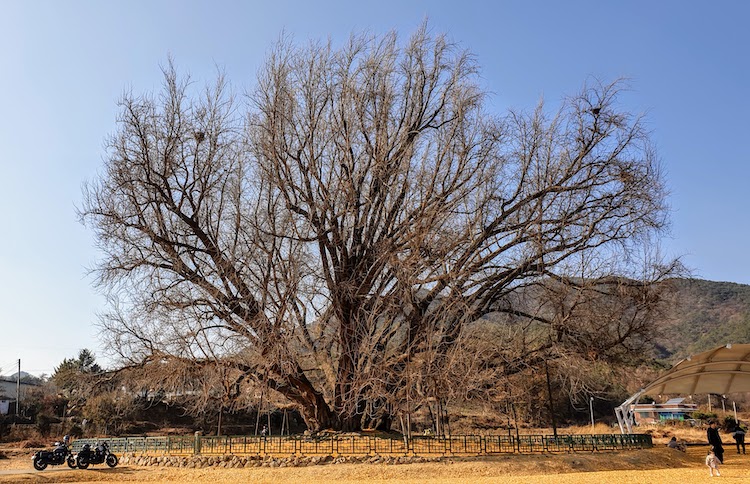
It was autumn of 2020 that Eric saw an article about a huge Gingko tree over by Wonju in Gangwon Province (the province that takes up the upper east half of South Korea, known most recently for hosting the 2018 Winter Olympics). The pictures were incredible and, being a tree of some significance, I thought it would be a great target for a hunt. Our book of trees had a few listed up that way, so I thought to put together a ride to check those off the list too. I’d already done a ride that started from a park in Yich’eon city about 30 miles northeast of where I live and another 20 from the Wonju gingko (which we took to calling the “Wonju Monster,” or the “Wonju Beast”), so that sounded like a good spot from which to start a ride. I convinced Chris and Joon to drive up to meet me at that park, and Eric took the train from Seoul. I had no idea when to go, so we settled on November 14th.
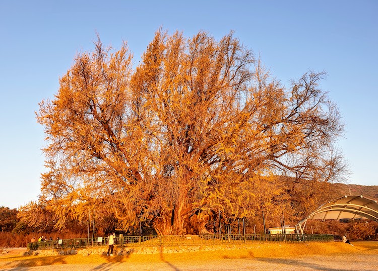
Which, it turns out, is too late. When we got there, the tree was bare. Still huge and beautiful, and surrounded by a sea of yellow on the ground, but pretty much empty itself.
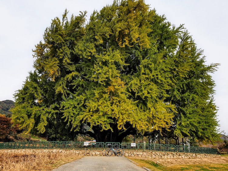
So I decided to try the same thing again in 2021 – parked in Yich’eon on October 30th and rode directly toward the tree. And this time, I was too early. It had a very slight tinge of yellow in some spots, but overall, it was still green. Rather than ride again the next week, Micha and I drove up on the 7th of November and were rewarded with a beautiful day and a beautiful tree (with crowds and parking far down the road, but worth it).
So I resolved to try again when the tree would be in full fall foliage, and figured that the 5th of November, 2022 (yesterday) would be a good time to go. This time, I drove to a temple in the city of Yeoju (about 15 miles east of Yich’eon, and set out at 6 AM for the Beast, which was only 12 miles from the spot, over one good climb.
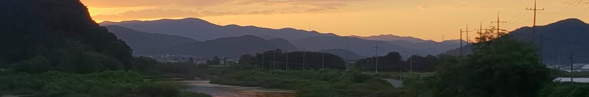
It was cold. While in 2020, the temperature at the start of the ride was 37, and in 2021, at the end of October, 42, yesterday’s starting temperature was below freezing at 26 degrees. As I set out, I found I’d layered pretty much perfectly for the ride but for one thing – I brought lighter gloves, and my fingers weren’t taking it too well. I had some toe warmers with me, and my feet felt fine, so I thought that maybe I could use them on my hands if I had to. I was cautious though – my hands usually fare well on rides after a bit, but my feet are a different story. Even if they feel fine early on, they would probably need the warmers later.
And this was exactly the case. My hands warmed up, but by the time I got to the Beast, my feet were starting to freeze (despite having on two pairs of socks, one of which was quite thick). I put the toe warmers in my shoes while I was stopped by the Beast, and that problem was solved.
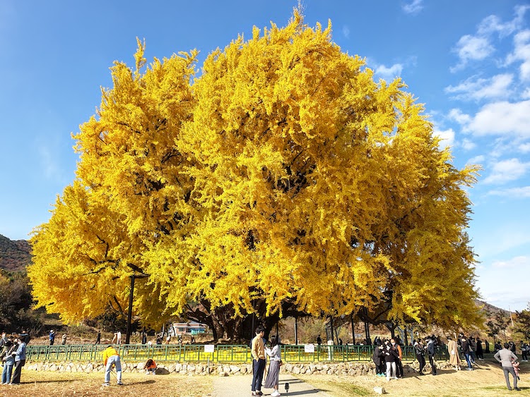
As for the Beast itself, more than half of the leaves were down – mildly disappointing, but still impressive (I’m thinking that it’s more about the temperatures — this year is cooler than last — than about exact dates). The sun rose about 5 minutes after I arrived, so the colors became more vivid and I got a couple of good pictures. There weren’t too many people, but at least three of them had drones, which was kind of interesting. Did make for a bit of buzzing though.
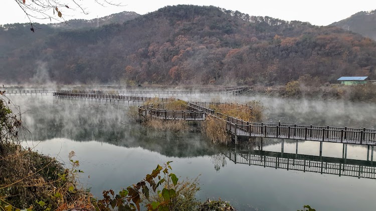
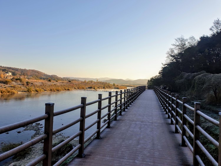
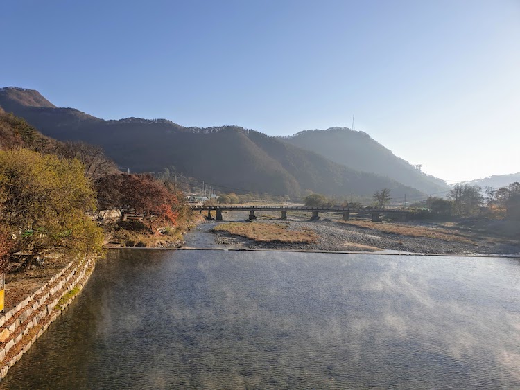
The rest of the ride was quite beautiful and excellent, with one minor problem. I was navigating with the route on Strava and my Naver map. The weather was cold, and my phone is a bit old, so the battery doesn’t fare well anymore. It was a bit disconcerting, then, when I pulled it out to take a picture only 25 miles into a planned 64-mile ride and it told me I was down to 7% battery power. I love to stop and take pictures along the way, so my first thought was that I wouldn’t be able to get any more shots for the rest of the ride – and there was a lot of ride left. But then the greater concern struck me — on long rides in unfamiliar areas, I have to check the map every so often to navigate. Especially in this case. If I missed a turn, or turned too early, I could find myself either going up a dead-end valley or heading in the wrong way altogether. I have a decent sense of direction, but in these mountains, there are few routes that go up over the ridges, so to miss one even if I thought I was heading in the right direction could be troublesome.
This is when I stumbled upon a new method of finding my way on a ride – a method that I’ve named “Navigation by Bus Stop.” One of the wonderful things about Korea is its well-developed system of public transportation, and so, even on out-of-the-way rural roads, there’s a good possibility you’ll find a bus stop somewhere. Fortunately, the bus stops in this area all had maps. Not super detailed — more like tourist maps — but enough to tell me where to turn.
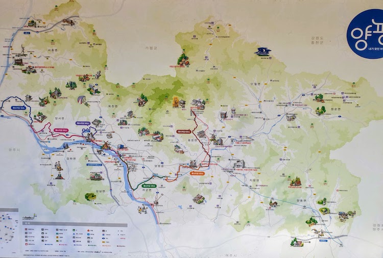
So I got over the ridge on the right road, and found a GS25 convenience store on the other side, where I convinced the cashier to plug my phone into his charger while I took a break and ate. That got me up to 13% which, with the phone in airplane mode and all of the apps but the camera closed, was enough to get me back to the car taking as many pictures as I wanted. As long as I checked a bus stop every so often (once I got out of that particular district, there were no longer maps in the bus stops).
I’d call that a success.
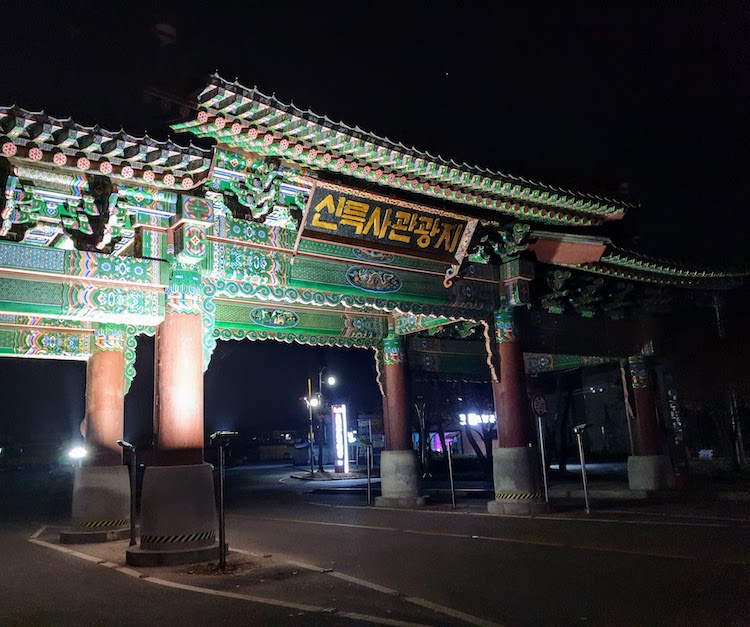
So I changed clothes, visited the temple (another story altogether that I hope to write about later), and decided to head for home without eating lunch (I ended up leaving the area at about 2). It was a wonderful day with a wonderful ride that I would do again (probably will next year), and, oddly enough, here it is Sunday morning and I feel like I’ve had a long weekend already. I should do this more often…
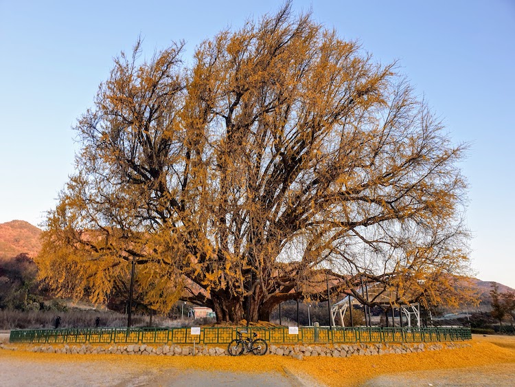
“Navigation by bus stop!” Was it due to the time of day or is the tree more orange this year than last?
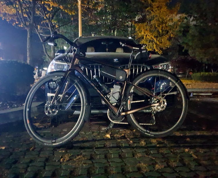
Yes, the sun had just gotten up. You can see in the pic with my bike that it was touching the mountains behind the tree already.