Part of my research into MSR1 was to develop the route for a ride from Songtan to Daejon (see my last post). I knew I couldn’t put together the logistics to make it happen this weekend, and I was sure I couldn’t make it a round-tripper, so I took a look at the route in hopes of finding a good spot to break off and return. I figured, 30-40 miles out, and 30-40 back would be good.
A few years back, I drove through the area south of Ch’eonan and I thought it was beautiful. A particular spot where the train and a highway followed the curve of some hills was especially intriguing to me, and it was about 35 miles south of here, so I started building my route with that as my goal.
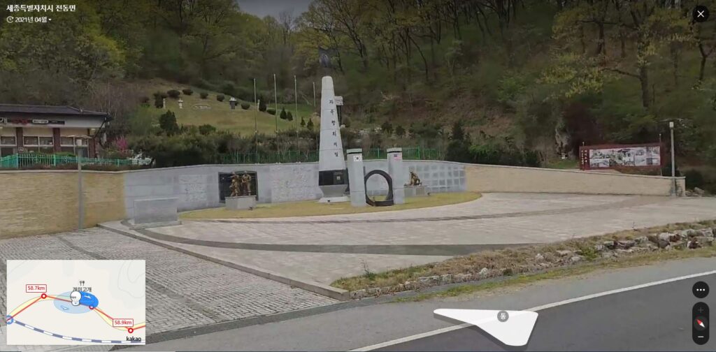
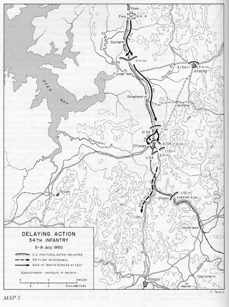
As I was planning the route, I noticed the hill I was shooting for was called “개미고개,” or “Ant Hill.” When I dropped down to street view, I saw a rather large monument by the side of road. A few days ago, I posted about 6.25 and Task Force Smith — the first time the US met the North Koreans (the anniversary of which is coming up next week). The US continued to fight delaying actions, through Pyeongtaek, Ch’eonan, and finally at Ant Hill, where 428 Americans died.
So what was originally going to be a long, beautiful ride, has now gained a historical aspect. I’m really looking forward to it. Stay tuned…