
Those who know me and my cycling exploits know that I’ve made a hobby of searching for special trees (and landmarks in some cases) as I go out. This is one of the great advantages of cycling in Korea – it’s packed with history and interesting stories to explore. [On a side note: I’ve often had to stumble through a Korean explanation as to why on earth I would want to go see a tree on someone’s property, and Saturday’s ride included convincing a security guard at a factory to let us onto the grounds to see a tree (no pictures allowed). It’s really part of the adventure.].
Last Saturday I went on perhaps my last great tree hunt. I’ve now pretty much accounted for every tree south of the Han River within reasonable range of my riding (there are probably a few left up to the Northeast in the Yi-ch’on area). This hunt was in the city of Gimpo.
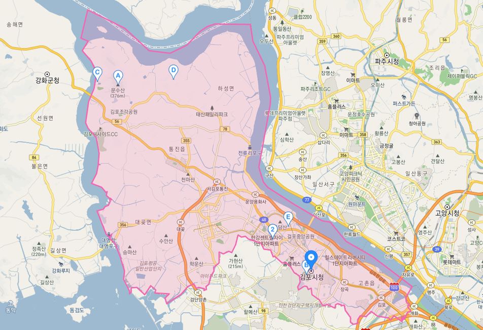
Gimpo is an interesting city. It kind of snuggles its way up to the Han River border with North Korea West of Seoul between Paju city and Ganghwa Island. When I hear the name, I always associate it with the airport. Until Inch’eon International Airport opened in 2001, Gimpo was the airport that served Korea. I came and went through it a few times, and I especially remember its security – probably because my last trip through it was in 1988 when, in addition to having a hostile neighbor to the north, there were some pretty big Olympics coming through within the next few months. Oddly though, Gimpo International Airport isn’t even in Gimpo anymore (maybe it never was – they redid “city” districts in the ‘90s).
So right now, the entirety of Gimpo city is north of the Airport, and while my recollection to get there always involved driving through the greater Seoul metro area, the city itself is actually quite rural. I’ve always thought of “Seoul” as one big blob of light on a nighttime map – a sprawling metropolis that pretty much covers the northern third of Gyeong-gi Province (Seoul and In-ch’eon are special city zones within the borders of Gyeong-gi, but not actually part of it). In reality, there is plenty of countryside up and around it. Some of it because of the mountains, especially to the north and east; but west and northwest of Seoul there’s surprisingly a lot of open farmland. And tucked away in these areas like Easter eggs you’ll find a few of these natural and man-made points of interest.
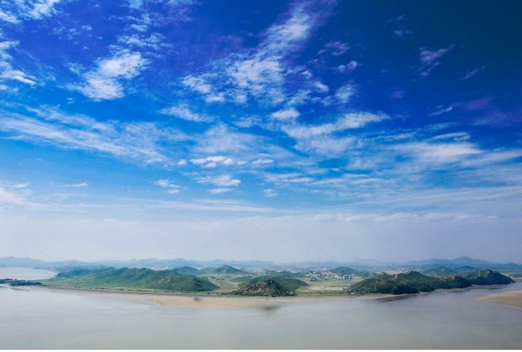
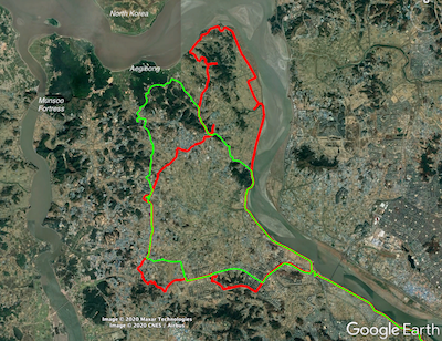
I’ve ridden in Gimpo twice now – once in September of last year and now just last week. Both of my rides were designed to pick up 10 story trees within Gimpo’s borders, and so I pretty much stuck to where these trees could be found – on the eastern half of the Gimpo “peninsula.” But looking at a map of the place opens up quite a few options. Like Aegibong Peak, sitting right in the middle of the northern edge – nestled in the middle of the cradle formed by the river. Aegibong has an “observatory,” which means the possibility of getting above the fence to see north Korea more clearly. From the blogs and pictures I’ve seen, it’s quite a nice view (I only hope it’s open when I get up there again).
And then there’s the Munsoo Mountain Fortress on the western edge. Built in 1694 during the Joseon dynasty, the fortress was meant to defend the northern entry to the passage between the mainland and Ganghwa island. I guess even the French fought there for some reason in 1866.
And throughout the rest of the area there are tombs and stones and villages that hold some kind of meaning. It all deserves at least one more good ride and I’m planning it already. I’m always up for a good adventure…